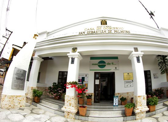
San Sebastián de Palmitas
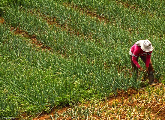
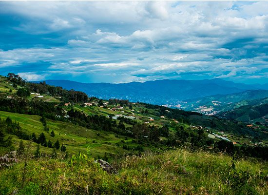
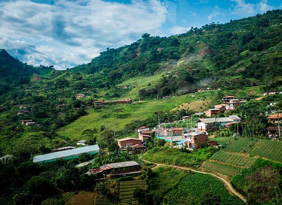
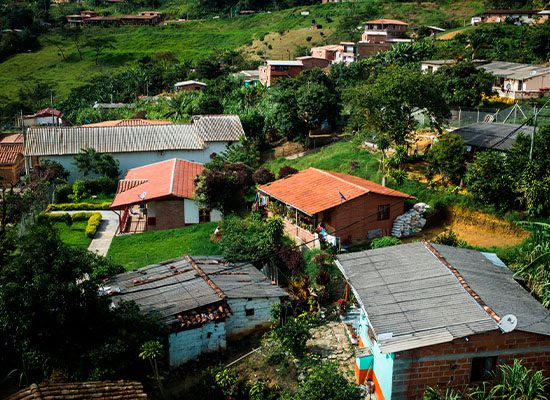
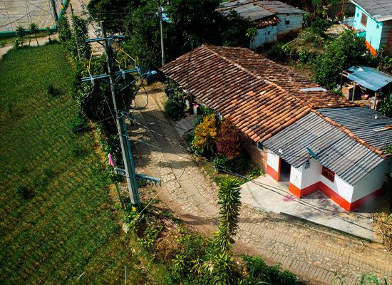
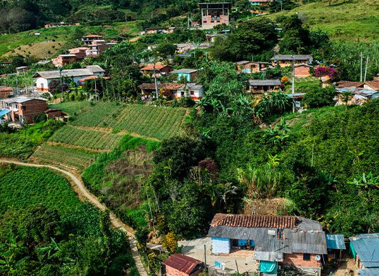
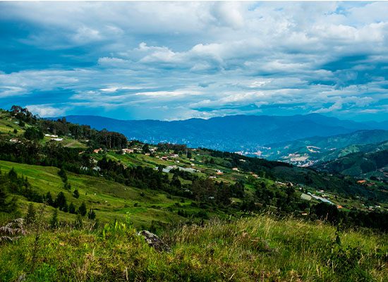
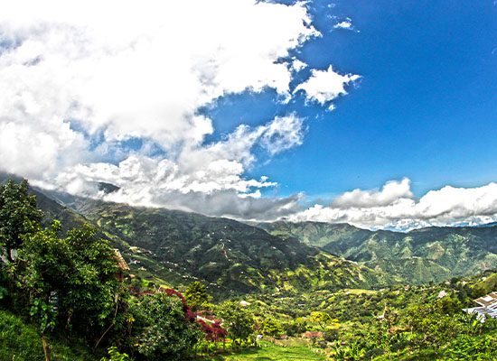
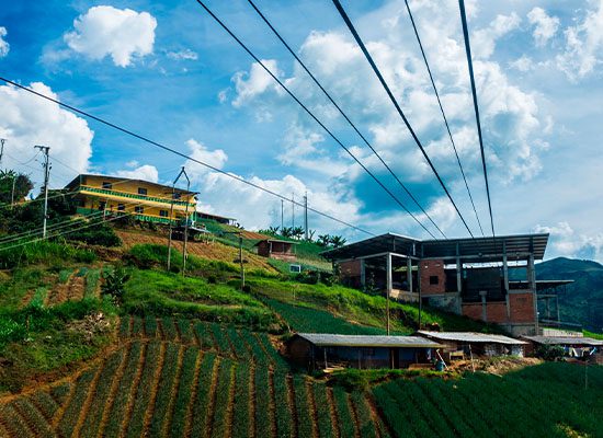
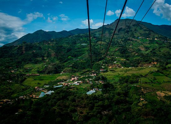
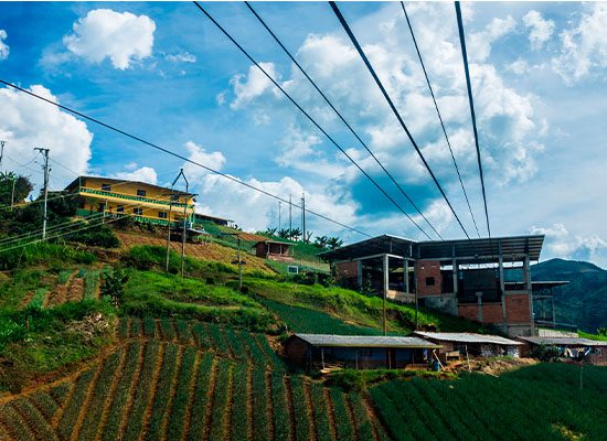
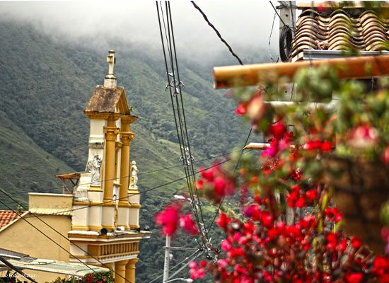
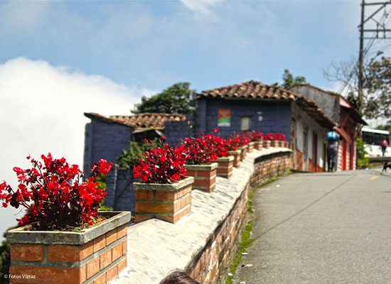
San Sebastián de Palmitas has been preserved over time as the most rural small town in Medellín. Visiting this place is quite an experience, especially if you enjoy its products and crops such as sour orange, peach palm, guava, orange, avocado, lemon, chayote, sugar cane, and coffee.
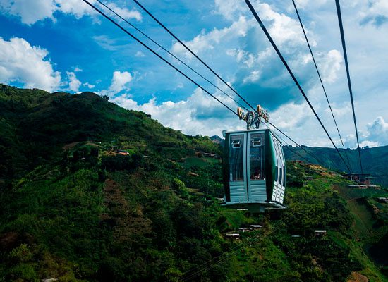
At the Casa de los Arboleda, you can learn eco-friendly agricultural techniques, go camping, or visit a waterfall with a five-meter drop. At the El Vergel farm, you can learn about the different systems in coffee production such as steam drying and the manual cable car.
Trapiche Fredy Cano is a sugar cane mill that represents a defining tradition of the small town: the planting of sugar cane for the production of panela (cane sugar).
In addition, thanks to its location, the El Tambo lookout point allows you to observe the process of birth of the clouds and enjoy the meeting of the warm currents that rise from the banks with cold blizzards that descend from the top of the mountain.
San Sebastián de Palmitas Road Network
The pre-Hispanic roads and bridle paths—transformed into deep canals by the weight of the loads—and the wider roads of the Spanish colonization for traveling comfortably on horseback and with carriages—such as the Camino del Virrey—are a sample of the stone roads that have carved the history of the inhabitants of San Sebastián de Palmitas. These roads have allowed the traditional mule and horse drivers of the small town to carry products grown there to be marketed in the city.
San Sebastián de Palmitas Lookout-Point Network
San Sebastián de Palmitas is found on a large mountainous complex that allows for panoramic views of the territory from many lookout points including Alto de la Cruz, Alto del Chuscal, El Morrón, La Popa, and El Ventiadero.
On the road in Antioquia that leads to the Caribbean coast, you can also see panoramic views of the border that separates the small town from the municipality of Ebéjico and western Antioquia. These are quiet and peaceful places where you can interact with nature and its flora and fauna.
Where Is San Sebastián de Palmitas and How to Get There?
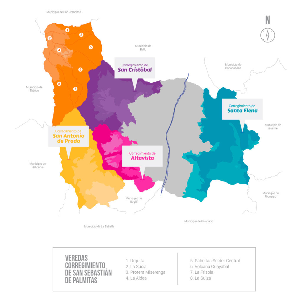
San Sebastián de Palmitas is located northwest of Medellín, at the gates of western Antioquia, bordering the municipality of San Jerónimo at the north, the small town of San Cristobal at the east, and the small town of San Antonio de Prado at the south.
There are two routes to get to San Sebastián de Palmitas by bus: one is the Sotraurabá buses that leave from the northern transport terminal three times a day and the other one is the Transportes San Cristóbal buses that are taken in downtown Medellín and offer seven schedules each day.
La distancia desde el Centro de Medellín hasta San Sebastián de Palmitas es de aproximadamente 22 kilómetros y el costo promedio del trayecto para el 2020 es de 35.000 COP, 9,10 USD. Desde el barrio Laureles la distancia es más o menos la misma, así como el costo promedio del trayecto.
La distancia desde El Barrio El Poblado, uno de los más populares entre los visitantes, es de 27 kilómetros y el costo promedio del trayecto para el 2020 es de 45.000 COP, 11,70 USD.
What to Do
It’s a road still in use with more than fifty years of service to the community. It allows the passage of mules loaded with sugar cane. The path goes through the rural settlements of La Frisola, La Aldea, and La Volcana. Along the way, visitors can observe native vegetation, mixed forest, low- and high-growing weeds, and plantations of sugarcane, onions, and coffee, as well as tributaries of the La Sucia stream. The road needs to be upgraded and maintained, since some stretches are in very bad condition due to the passage of animals.
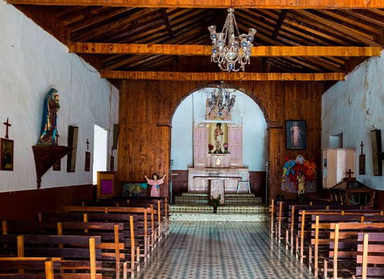
Still in a good state of conservation, this temple was the first chapel of San Sebastián. The spatial layout of the building is very simple, having practically no architectural ornamentation. The chapel has rammed-earth walls plastered with cement at the bottom and cement tiles replacing the old trodden-earth floor. It’s a good example of traditional Colombian religious architecture.
From this natural viewpoint, you can appreciate the Cauca River valley and the municipalities of San Jerónimo and Santa Fe de Antioquia. The area is home to native vegetation, low-growing weeds, and plantations of sugar cane, onions, and coffee. It’s also a popular spot for watching sunsets. However, its proximity to the road leading to western Antioquia brings a high level of particulate matter from passing vehicles. This viewpoint is also near a road that connects to other rural settlements in the area.
It’s a representative coffee farm in the agricultural production sector of the small town. It harvests coffee twice a year, which is sold to local clients who then sell them in different municipalities.
The cockpit is located in the rural settlement of La Aldea and can be reached after a 20-minute drive from the central part of the small town. It has been in operation for more than ten years. Gamblers who come to the cockpit must bring their own gamecock and make a minimum payment to the judge. Spectators can also make their bets. The place also offers its customers pool tables and slot machines.
The church is characterized by its spatial and formal simplicity. Its different constituent elements are well preserved. Beyond its simple structure, the building stands out in the urban context for the ornamental elements of its facade, making it a harmonious set.
The old house of Los Bastidas is an 1896 construction whose original structure—including the roof, corridors, doors, windows, and rammed-earth walls—is still preserved. Its owners keep the original deed of the property, which reports that the sector where the house is located was called Las Vueltas. The last buyer inherited the house to his wife and children who currently use it as a recreational farm. It’s surrounded by ample green areas and adorned by a beautiful garden that gives it an even more traditional atmosphere.
This sugar cane mill has been in operation for approximately 60 years. The Muñoz Muñoz family inherited this productive activity years ago. To reach this place, you need to go down a bridle path where you can observe mixed vegetation and sugar cane, coffee, and onion crops.
Alto de la Cruz is a hill located next to the road in Antioquia that leads to the Caribbean coast. The hill is in front of the road-side restaurants at the entrance to the urban area of the small town. Its name comes from a cross that used to be on the top. In Alto de la Cruz, there is a lot of agricultural and livestock activity, as well as occasional timber exploitation, mostly of patula pine. The area has been totally intervened and the expansion of the agricultural frontier is very evident, completely displacing the natural conditions of the site.
El Morrón is an important populated sector of the La Sucia rural settlement where approximately 80 families live. From there, you have a beautiful panoramic view of the central part of the small town, the La Frisola rural settlement, the Alto de Boquerón hill, the municipality of Sopetrán, and the small town of San Antonio de Prado. This viewpoint has a lot of vegetation and is not located near any main road; therefore, smog pollution is very low in the area. However, the extensive use of agrochemicals for the vegetable crops grown in this area pollutes the streams.
The lower part of the hill is characterized by notable human intervention, with a significant number of settlements dedicated to productive activities, mostly agricultural. The exploitation of natural resources drastically modified the natural conditions of the site, displacing the native fauna and flora. Similarly, water sources have been affected by direct discharges, surface runoff of sewage and fertilizers, constructions, and landscape modification.
The lower part of the hill is characterized by notable human intervention, with a significant number of settlements dedicated to productive activities, mostly agricultural. The exploitation of natural resources drastically modified the natural conditions of the site, displacing the native fauna and flora. Similarly, water sources have been affected by direct discharges, surface runoff of sewage and fertilizers, constructions, and landscape modification.
El Ventiadero is a natural viewpoint situated on the road that leads to the rural settlements of La Frisola and La Suiza, marking the boundary between them. From there, you can see a wide panoramic view of the municipality of Ebéjico and the small town of San Antonio de Prado, as well as the municipalities of Santa Fe de Antioquia, Sopetrán, San Jerónimo, and part of the Cauca River valley. Besides native and secondary forest, you can appreciate sugarcane and onion crops that are grown in this area. However, the debris and garbage present in the place give a very bad appearance and the power poles might block the view.
The La Frisola stream is a tributary of the La Sucia stream, which eventually flows into the Cauca River. Along its course to its mouth, you can observe a natural forest mixed with plantations of sugar cane, coffee, and other crops. To reach La Frisola, you follow a bridle path and cross a bridge built entirely of wood over 50 years ago. However, due to its poor condition, the bridge has been reinforced with cement.
La Misserenga springs in Alto del Chuscal and flows into the La Sucia stream. It runs east-west through the small town and supplies water for human consumption in the rural settlement of Urquitá. It’s surrounded by vegetation and native trees, contributing to the scenic beauty of the site. During its course, the stream forms pools where visitors can bathe.
La Sucia stream originates from the Padre Amaya hill and flows a short distance to the bridge bearing its name, where it joins the La Volcana stream, naturally forming spectacular pools frequented by locals. The powerful flow of water striking massive rocks along the streams creates soothing sounds, adding to the natural spectacle. Along its course, La Sucia supplies water to poultry tanks in Los Gaiteros, although its quality is less than ideal, hence its name that translates “The Dirty”.
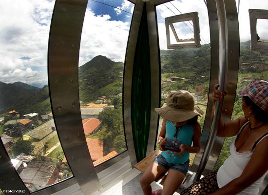
Located between the rural settlements of La Aldea and La Potrera, about one and a half kilometers by car from the Túnel de Occidente, this viewpoint sits near the busy road to western Antioquia. While the wind brings pollution from the road and the view is partially blocked by a manual cable car, you can still enjoy a panoramic view and observe diverse flora and fauna.
This waterfall of approximately 20 meters is found next to the new road in Antioquia that leads to the Caribbean coast, four kilometers after crossing the Fernando Gómez Martínez tunnel. Although vehicle traffic causes pollution in the area, targeted interventions could help restore its beautiful landscape.
Alto del Chuscal is the source of the Misserenga stream. This hill is visited for its panoramic view of the municipalities of Santa Fe de Antioquia, Ebéjico, and San Jerónimo and the small town of San Sebastián de Palmitas. At the top of the hill, where there is a statue of Virgin Mary, religious celebrations are held, especially in May. The hill is in a densely populated and modified area, which restricts its natural state. Although it has very attractive landscapes and views, the hill is not very rich in terms of fauna and flora.
La Volcana stream is one of the most important streams in San Sebastián de Palmitas. It irrigates this territory from east to west and flows into La Frisola stream, which in turn is a tributary of La Sucia stream that defines the western boundary of the small town before flowing into the Cauca River. There are two sites along the stream with natural pools: one next to the road and another near the cemetery and the muleteer path. This second place has flat banks appropriate for camping with a capacity of up to 25 tents.
Luz Elena Galeano has been an artisan for about nine years. She lives with her husband and two daughters in the rural settlement of La Aldea in the small town of San Sebastián de Palmitas. Their house has adobe and cement walls, wooden roof, and clay tiles. Luz Elena uses materials such as wire, paper, veiled stockings, seeds, cardboard, straw, clay, and small beads to make bags, floral arrangements, animal figures, bracelets, necklaces, and bonsais. People often hire her to make arrangements for baptisms, first communions, marriages, and other celebrations.
Spaniards, settlers, and muleteers traveled along pre-Hispanic roads from the mother city of Santa Fe de Antioquia to Medellín to conquer new lands and market their products. These paths go across the territory that today is known as the small town of San Sebastián de Palmitas. Due to road and connection difficulties in the area, the small town currently preserves the muleteer tradition. Therefore, the mule is still the means of transportation for many farmers who travel on Sundays to the urban area of the small town.
The festivities of San Sebastián are held in honor of Saint Sebastian, the patron saint of the small town. The event takes place on January 20 and is organized by the inhabitants of the rural settlement of La Aldea. They clean the chapel and parade the statue of the saint on a float down the streets of the small town, praying the rosary and singing songs. The procession ends in the chapel with the celebration of the holy mass. Then, people participate in bazaars, light candles to the saint, and enjoy other activities.
Information for Tourists
The following grassroots initiatives or organizations can assist you with tourism services in the small town of San Sebastián de Palmitas:
Corpalmitur Representative – Nature Tourism, Ecotourism, and Agrotourism
Luz Elena Ríos: +57 6043870667 | +57 3122149384 | +57 3216364732
Recommendations
- Bring a tourist map of the small town and find out about the topographical and climatic conditions of the areas you plan to visit. In addition, make a copy of your passport, medical assistance card, and other documents.
- Use sunscreen even if it’s cloudy or sunless. Wear comfortable shoes and warm clothes, especially in the afternoon and at night, as the temperature can drop considerably.
- Since it’s a rural environment, you may have to be prepared for long walks; proper food and hydration will allow you to be on your feet during the whole route.
- Enjoy forests, lakes, historic roads, farms, and other spaces responsibly. Don’t leave your litter in these places or damage the flora and fauna of the territory.
- In addition to a camera with enough space, bring binoculars to closely observe the flora and fauna found in the area.
- Invest in the territory, support local businesses by buying their products
Through the Buy Locally initiative, you can support the projects of producers, farmers, and artisans from the small towns of Medellín.
